A South-Park Day Trip from Joshua Tree: Cholla Cactus Garden, Cottonwood Spring and Mastodon Peak
Plan a Joshua Tree National Park south-end loop: Cholla Cactus Garden, Cottonwood Spring, Mastodon Peak or Lost Palms Oasis, with fees, drive times and Oct. 21 conditions.

On this page
The best long day trip from Joshua Tree this week is a loop through the quiet south end of Joshua Tree National Park. Enter at the North Entrance in Twentynine Palms, drive Pinto Basin Road to the Cholla Cactus Garden, hike from Cottonwood Spring to Mastodon Peak (3 miles) or Lost Palms Oasis (7.5 miles), then exit the South Entrance to I-10 and come home on Highway 62. It's about 140 miles of driving with a $30 park vehicle pass. The park had no closures posted for the south end this morning, and Friday has the calmest forecast.
Updated Wednesday, Oct. 21, 2026, 7:15 AM PT
Is the south end of Joshua Tree National Park open this week?
Yes. This is what official sources reported this morning:
- Joshua Tree National Park: the park's alerts and conditions page listed no active closures for Pinto Basin Road, the Cholla Cactus Garden, or Cottonwood Spring. The Geology Tour Road closure posted after the Oct. 11 storm no longer appears in the park's alerts. Ask at a visitor center before you drive that dirt road, though, and remember the park keeps a map of current closures for roads, trails, and campgrounds.
- Highway 62 east of Twentynine Palms: Caltrans still shows SR 62 closed from 2.4 miles east of Twentynine Palms, at Godwin Road, to the SR 177 junction because of flooding. That doesn't affect this loop. The park's North Entrance is on Utah Trail in town, west of the closure.
- I-10: Caltrans listed no restrictions on the desert stretch between the park's South Entrance (exit 168) and Highway 62. The only I-10 notices this morning were in Los Angeles County and the city of San Bernardino.
- Mojave National Preserve: if you were thinking about Kelso Dunes instead, the preserve's alerts still warn that storms flooded, damaged, and left debris on roads throughout the preserve. That alert runs through Oct. 31, and the Kelso Depot visitor center remains closed for heating and cooling repairs. The south end of Joshua Tree is the easier bet this week.
How far is it, and how long does the drive take?
From our shop on 29 Palms Highway in Joshua Tree, it's roughly 15 miles east to Twentynine Palms and the park's North Entrance. From there, the park's distance chart puts the Cholla Cactus Garden 20 miles from the Joshua Tree National Park Visitor Center in Twentynine Palms, and Cottonwood Spring 40 miles away. Cottonwood Visitor Center sits about 7 miles from I-10.
| Leg | Distance | Drive time (estimate) |
|---|---|---|
| JT Trading Post to Twentynine Palms and the North Entrance | about 15 miles | about 20 minutes |
| North Entrance to the Cholla Cactus Garden | about 20 miles | about 40 minutes |
| Cholla Cactus Garden to Cottonwood Spring | about 20 miles | about 40 minutes |
| Cottonwood Spring to I-10 (exit 168) | about 7 miles | about 15 minutes |
| I-10 west and Highway 62 back to Joshua Tree | about 79 miles | about 1 hour 35 minutes |
That comes to about 140 miles and roughly 3.5 hours behind the wheel. The NPS figures are official, but the drive times and the last leg are routing estimates, not official numbers. Fill your tank in Twentynine Palms before you go in.
What does it cost to get in?
Per the park's fees page:
- Private vehicle: $30, good for 7 days for everyone in the car
- Motorcycle: $25 for 7 days
- On foot or by bike: $15 per person, age 16 and up
- Joshua Tree Annual Pass: $55
- America the Beautiful pass: $80 for the annual resident pass, $20 for the senior annual pass. Military, Access, and 4th Grade passes are free.
The North Entrance station takes credit or debit only. Cottonwood Visitor Center takes cash or card.
What is there to see at the Cholla Cactus Garden?
The Cholla Cactus Garden is a flat 0.25-mile loop through thousands of teddy bear cholla in the Pinto Basin, where the Colorado and Mojave deserts meet. The NPS lists it as wheelchair accessible and says it takes 15–30 minutes. The cholla grow so thickly here because detached stems root where they fall, and they're mostly too heavy for the wind to carry far.
The park calls them "jumping" cholla for a reason. Segments break off and latch onto shoes, legs, and dogs. Wear closed-toe shoes and stay on the trail. Early morning light is the prettiest time to walk it.
Which hike should you do from Cottonwood Spring?
Cottonwood Spring is a fan palm and cottonwood oasis about 7 miles inside the South Entrance. The NPS says earthquake activity formed it, and that the Cahuilla used it for centuries, leaving bedrock mortars and ollas in the area. It later became a water stop for miners and teamsters, and the remains of gold mills are still nearby. It's also one of the park's best birding spots. These distances come from the park's hiking page:
- Cottonwood Spring: 0.1 mile, about 10 minutes. A short walk to the oasis, with plenty of shade.
- Bajada Trail: a 0.25-mile loop, 15–20 minutes, half a mile north of the South Entrance. An easy introduction to Colorado Desert plants.
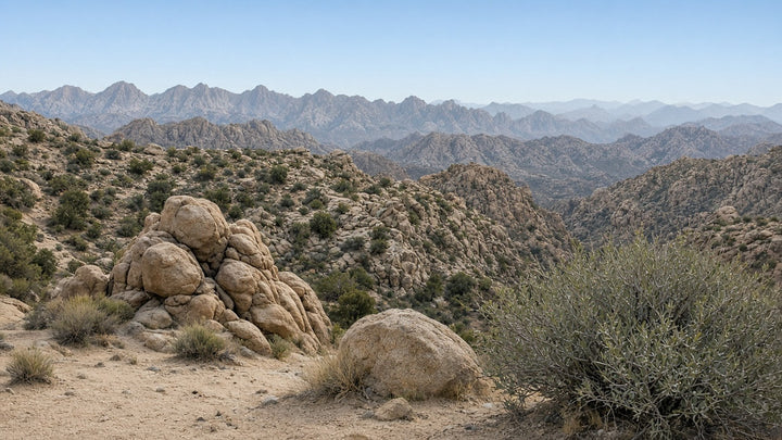
- Mastodon Peak: a 3-mile loop with 375 feet of elevation gain. The NPS trail page estimates 2–3 hours and calls it moderate. It passes the Mastodon Mine and the Winona Mill site, with an optional scramble to the craggy granite summit. There's no shade and no cell service.
- Lost Palms Oasis: 7.5 miles round trip with 500 feet of gain, 5–6 hours. The trail crosses sandy washes and rolling terrain, then drops into a canyon holding the park's largest stand of fan palms. The NPS calls it difficult, and the climb back out of the canyon is the hardest part. You can combine it with Mastodon Peak for a longer day.
For most people, Mastodon Peak plus a sit at the spring is the right size for a day that already includes three-plus hours of driving. Save Lost Palms for a day when you start early and carry plenty of water.
What's the weather this week?
These are this morning's National Weather Service forecasts for Cottonwood Spring and the Cholla Cactus Garden area:
- Wednesday (today): sunny, high near 74°F at Cottonwood and 79°F at the cholla garden, with south wind gusting to 25 mph
- Thursday: sunny and cooler, highs near 67°F and 71°F, gusts to 20–25 mph. The Joshua Tree forecast adds a 20% chance of isolated showers and thunderstorms between 1 and 3 PM.
- Friday: sunny, highs near 66°F and 70°F, with a light northwest wind of 5–10 mph. This is the pick.
- Saturday: sunny, highs near 68°F and 71°F, but with north wind of 15–25 mph gusting as high as 35 mph
- Sunday: sunny, highs near 69°F and 73°F, with a light north wind
No weather alerts were posted for either spot this morning. The sun sets at 6:02 PM today and 5:59 PM Saturday at Cottonwood, per the U.S. Naval Observatory. Plan to be off the trail well before then.
What does a good south-park day look like?
- 7:00 AM: leave Joshua Tree with a full tank, at least a gallon of water per person, snacks, and a park map. The NPS notes there's no cell service on the Mastodon Peak trail.
- 7:20 AM: enter at the North Entrance in Twentynine Palms (card only), then head south on Pinto Basin Road.
- About 8:00 AM: walk the Cholla Cactus Garden loop in the low light.
- About 9:00 AM: stop at Cottonwood Visitor Center, open daily 8:30 AM–4 PM per the NPS, for water, restrooms, and trail conditions from a ranger.
- 9:30 AM–12:30 PM: walk to Cottonwood Spring, then hike the Mastodon Peak loop. Lost Palms hikers should be on the trail by 9:30 at the latest.
- Early afternoon: have a picnic at Cottonwood, exit the South Entrance to I-10 west, and take Highway 62 north home through Morongo Valley and Yucca Valley.
Aside, if you go Saturday: run the loop in reverse, starting on I-10 and ending at the North Entrance, and you'll land in Twentynine Palms for the season finale of the free Levitt AMP Twentynine Palms Music Series on Saturday, Oct. 24, with Mark Taylor and Los Poncho Tones at Freedom Plaza. The plaza opens at 6 PM, and music runs 7–9 PM. More dates are on our Around Town calendar.
What should you know before you go?
- Pets: the park allows leashed pets (6-foot leash maximum) only within 100 feet of roads, picnic areas, and campgrounds. Pets are not allowed on trails, including Mastodon Peak, the Cholla Cactus Garden, and Lost Palms, per the NPS pets page.
- Leave No Trace: stay on the trail at the cholla garden, pack out everything you bring, leave rocks, plants, and mining artifacts where they are, and give bighorn sheep and the oasis water plenty of room.
- Safety: tell someone your route and when you'll be back. Trails at the south end are mostly unshaded.
Stop by on your way
If you're heading out Highway 62 this week, come see us at JT Trading Post, 61716 29 Palms Hwy, Joshua Tree. More than 40 local vendors share the shop, and it's an easy place to pick up a desert-made souvenir on the way home. Hours are Mon–Fri 12–5 PM and Sat–Sun 8 AM–5 PM. You can also shop online at jttradingpost.com.
Frequently asked questions
How far is Cottonwood Spring from Joshua Tree?
About 55 miles through the park: roughly 15 miles from Joshua Tree to the North Entrance in Twentynine Palms, then 40 miles down Pinto Basin Road, according to the NPS distance chart. Plan on a bit over an hour and a half each way.
How long is the Lost Palms Oasis hike?
The NPS lists it as 7.5 miles round trip with 500 feet of elevation gain, taking 5–6 hours. The rocky climb back out of the oasis canyon is the hardest part.
Is the Cholla Cactus Garden open?
Yes. The park listed no closures for the Cholla Cactus Garden this morning. The 0.25-mile flat loop is open year-round. Wear closed-toe shoes and stay on the trail.
Can I bring my dog to Cottonwood Spring or the Cholla Cactus Garden?
Not on the trails. Leashed pets are allowed only within 100 feet of roads, picnic areas, and campgrounds, so your dog can't join you at the cholla garden loop, Mastodon Peak, or Lost Palms Oasis.
Is Highway 62 open east of Twentynine Palms?
Not right now. Caltrans lists SR 62 closed from Godwin Road, 2.4 miles east of Twentynine Palms, to SR 177 because of flooding. The park's North Entrance and this loop aren't affected.
Sources
- Joshua Tree National Park alerts and conditions, NPS
- Fees and passes, Joshua Tree National Park
- How Far Is It? distance chart, Joshua Tree National Park
- Hiking, Joshua Tree National Park: trail distances, elevation, and times
- Cottonwood Spring, Joshua Tree National Park
- Cholla Cactus Garden, NPS
- Hike Mastodon Peak, NPS and Hike Lost Palms Oasis, NPS
- Visitor centers and operating hours, Joshua Tree National Park
- Pets, Joshua Tree National Park
- Mojave National Preserve alerts and conditions, NPS
- Caltrans highway conditions, SR 62 and I-10
- National Weather Service forecasts for Cottonwood Spring, the Cholla Cactus Garden area, and Joshua Tree
- U.S. Naval Observatory sun and moon data: sunset times
- Levitt AMP Twentynine Palms Fall Concert Series, Visit 29 Palms
Hi-Desert Field Desk is JT Trading Post's events and guides desk in Joshua Tree. We check every date, price, and closure against official sources the morning we publish.